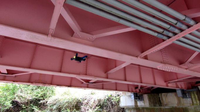
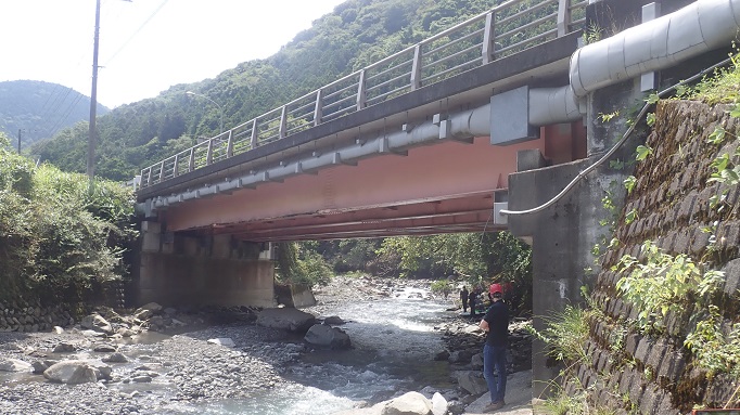
Field Experiment in Yamanashi.
We are developing a method to evaluate the current state of structural health conditions and the situation at disaster sites by combining drone measurements and AI.
These photos show a drone taking photographs of the Sakamoto Bridge, a national highway bridge in Yamanashi Prefecture, in order to evaluate the structural health condition of the bridge by getting as close as possible to the girders and slabs.
The images were taken with a commercial drone that has a vision based navigation functions, such as manual flight function with the obstacle avoidance and autonomous flight function with the 3D mapping / way-point navigation.
By conducting measurements in the field, we came up with various ideas on how to utilize the drone and the AI to be developed.